Terrain erosion part III
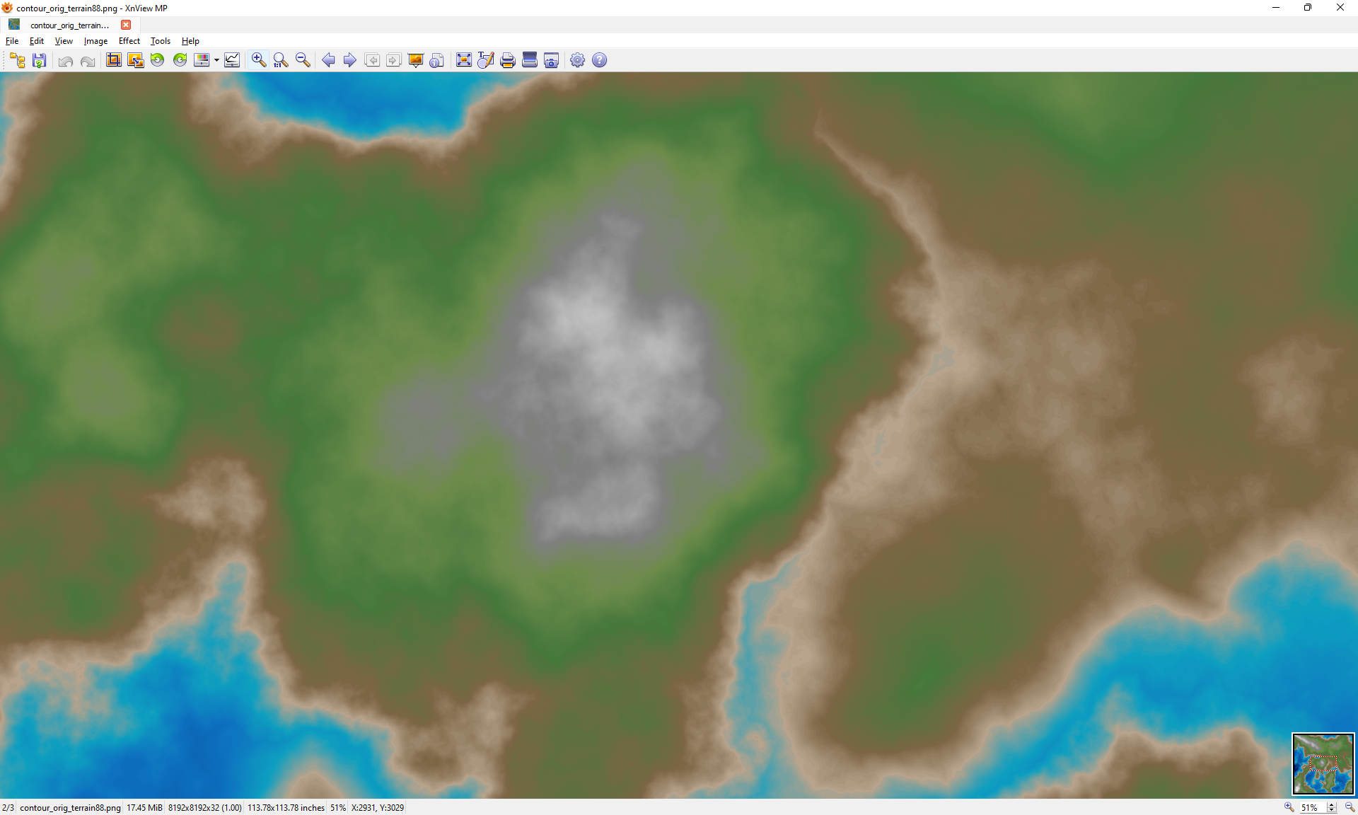
Last part of my terrain erosion series. Here are some example images showing a couple before and afters of my hydraulic erosion simulation. Tested on a 8192x8192 game map, one pixel represents one tile. These images show a small fraction of the smallest possible game map.
Before:
After:
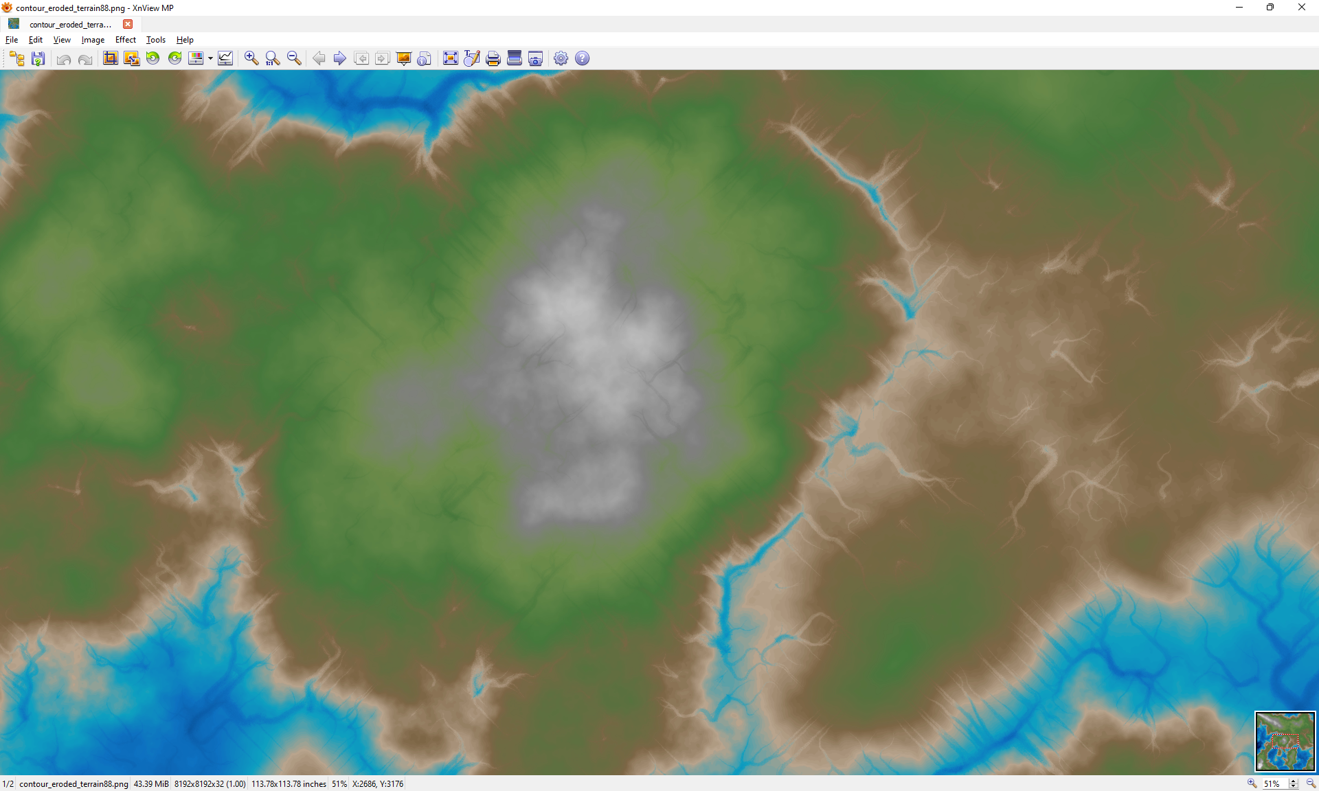 (light blue to black colors represent water, grey to white represent mountains and snow)
Here are some more, but zoomed in further:
Before:

After:
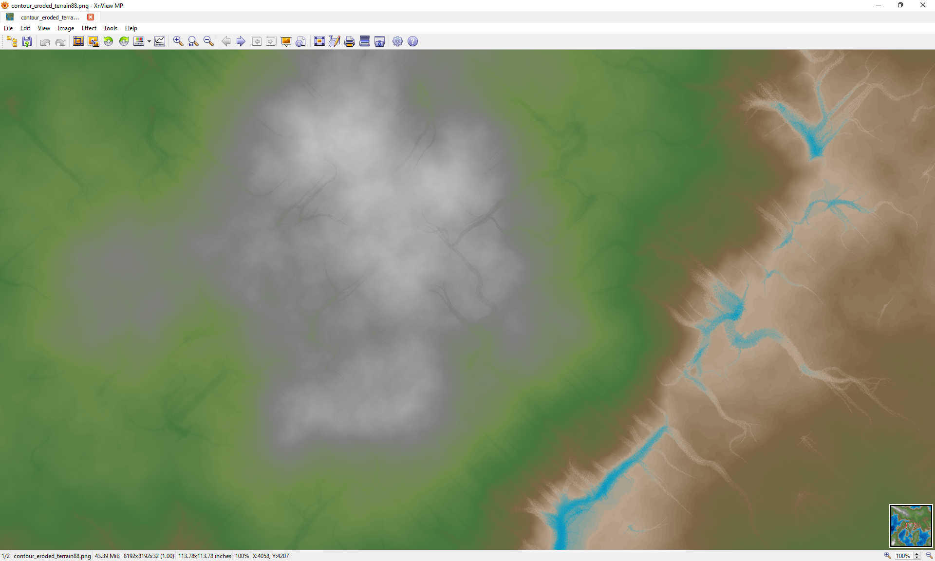
On my 8-core dev machine the erosion sim carved over 16,000 separate paths through the terrain in about 30 seconds. There are already quite a few variables in place to allow tuning the process. The image above roughly equates to medium density, medium intensity, and with maximum coverage (no map sections left out). I can currently limit areas based on average elevation, and further along my worldgen process I'll take into account precipitation levels for particular biomes.
Next up I'm going to start on OpenGL graphics and UI code so that I can plug in the beginnings of my worldgen code.